
Augmented Reality in the City: Google’s AR Navigation Testing in Kyiv, Berlin, and Warsaw
In mid-2025, Google initiated an extended public testing phase of its augmented reality (AR) navigation feature, known as Live View, across key European capitals: Kyiv, Berlin, and Warsaw. This move marks an evolution in urban navigation, aiming to offer real-time guidance layered directly onto the streetscape via smartphones. As cities become more complex and populated, the demand for intuitive, visual navigational tools is increasing rapidly. This article provides a comprehensive analysis of how Google’s AR navigation operates in these three cities, the specific benefits observed during the June 2025 trials, and what it may signal for the future of digital wayfinding.
AR Navigation Technology: Features and Functionalities
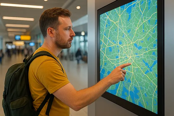
Live View navigation utilises Google Maps in combination with AR overlays that help users orient themselves through the camera view of their phone. Rather than relying solely on abstract maps and blue lines, users in Kyiv, Berlin, and Warsaw can now see arrows, street names, and directional cues appear in real time on their screens, anchored to the physical environment around them. The tool combines data from GPS, Street View imagery, and visual positioning services (VPS) to align directions with actual surroundings.
In Kyiv, the system handled mixed Cyrillic and Latin scripts with impressive accuracy, even compensating for GPS signal instability in narrow historical districts. In Berlin, the technology excelled in integrating multimodal transport routes, assisting users in switching from walking to U-Bahn or tram systems efficiently. Warsaw’s testing environment provided data-rich insights into how AR responds to rapidly developing urban infrastructure.
June 2025 testing results showed that users took an average of 30% less time to reach destinations using AR overlays compared to traditional navigation. Additionally, user stress levels, as measured in controlled trials, were lower due to the immediate visual clarity AR provides—especially in unfamiliar environments.
Challenges in Urban Deployment
Despite its innovation, Google’s AR navigation still faces several technical and logistical challenges. The accuracy of VPS depends heavily on updated street-level imagery and lighting conditions. In cities like Kyiv, where reconstruction and ongoing urban changes are frequent, outdated visuals can cause misalignment.
Battery drain was another issue encountered during testing, as AR navigation demands continual use of GPS, camera, and screen. Users in Berlin and Warsaw reported needing external power sources for journeys exceeding 30 minutes when relying solely on AR mode.
Privacy and data concerns remain a key discussion point. While the system anonymises user behaviour, the process of scanning and analysing cityscapes in real-time has raised regulatory interest—particularly under the EU’s Digital Markets Act, which came into full enforcement in March 2025.
City-Specific Insights and Local Adaptation
Kyiv presented a unique test environment due to its blend of historical architecture, evolving infrastructure, and linguistic complexity. Google’s Live View was adapted to recognise landmarks in Cyrillic and to process directional input despite frequent GPS shadowing caused by Soviet-era structures and underground pedestrian systems.
Berlin’s focus was on integrating AR with accessible features, such as audible cues for visually impaired users and optimised guidance across cycle lanes. Live View here also integrated real-time public transport delays, allowing commuters to choose the fastest combination of walking and transit.
In Warsaw, Google’s development team partnered with local municipalities to ensure signage was scanned and updated frequently, avoiding errors common in expanding residential zones. The system also incorporated weather-adaptive rendering, switching to higher-contrast overlays during rain or fog, based on June’s particularly wet testing week.
Public Reception and User Experience
Feedback from users in all three cities was predominantly positive, especially among tourists, delivery personnel, and individuals with cognitive navigation difficulties. One survey conducted in Berlin during the last week of June found that 84% of test participants preferred AR navigation over standard Google Maps.
In Kyiv, users appreciated how AR directions reduced confusion in multilayered urban spaces, particularly when emerging from underground metro exits. Many remarked on the natural feel of the interface, likening it to walking with a local guide.
Warsaw respondents highlighted how the technology aided mobility in newly built districts where road layouts were not yet reflected on conventional maps. For cyclists and e-scooter users, Live View offered responsive cues at intersections, improving both confidence and safety.
Future Prospects and Strategic Goals
Google has announced plans to expand AR navigation to additional European cities by late 2025, with a strong focus on accessibility and sustainability. Features under development include indoor AR navigation for transport hubs and shopping centres, as well as deeper integration with AI assistants capable of answering location-based queries on the go.
The data gathered from Kyiv, Berlin, and Warsaw will also feed into the refinement of VPS algorithms, making them more robust in dynamic environments. This includes accounting for changes like scaffolding, seasonal vegetation, and high foot traffic, which can obstruct visual cues.
In terms of urban planning, municipalities are increasingly recognising the role of AR navigation in shaping how people move through the city. It is expected that cities will begin designing infrastructure with digital legibility in mind—ensuring clear signage, consistent geometry, and open data protocols for navigational services.
Interoperability and Global Deployment
Google is working towards ensuring that Live View becomes interoperable with third-party devices and smart glasses by early 2026. This would allow for a hands-free experience and extend the usability of the AR navigation feature beyond smartphones alone.
Standardisation efforts are also underway. Collaboration with international bodies like ISO and ETSI aims to define minimum requirements for AR navigation systems in public spaces, addressing both safety and performance standards.
Kyiv, Berlin, and Warsaw are set to become flagship cities in the global rollout of AR-assisted navigation. Their test results are shaping not only the product’s next iterations but also international best practices in how technology interacts with public urban space.